*** OFF THE MARKET ***
Irrigated Pasture
Apache County, Arizona
Pictures
Please click on any of the pictures
for a larger view
|
|
|
|
[1] |
[2] |
[3] |
|
|
|
[4] |
[5] |
[6] |
|
|
|
[7] |
[8] |
[9] |
|
|
|
[10] |
[11] |
[12] |
|
|
- |
[13] |
[14] |
- |
Location & Maps
Please click on any of the maps
for a larger view
|
|
|
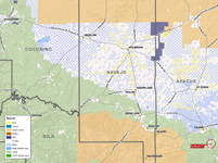
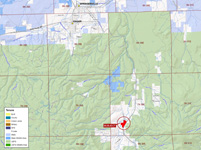
Location map |
Neighborhood map |
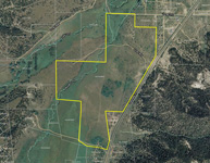
Aerial map |
Location & Access
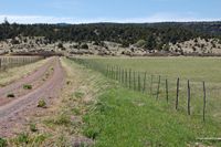
The property is lfocated in central Apache County, Arizona, between Alpine and Springerville along US Highway 180 in the Nutrioso Valley at the confluence of Colter Creek and Nutrioso Creek. Access is provided by US Highway 180 approximately twelve miles south of Springerville to the property. There is over ¼ mile of paved frontage along the main highway and frontage on both the north and sound property boundaries on gravel, county maintained roads.
Land Tenure
118.67 deeded acres
Legal Description
Township 7 North Range 30 East
Gila and Salt River Baseline and Meridian
Portion of Sections 29 & 32
Apache County Assessor parcel number 102-43-005D
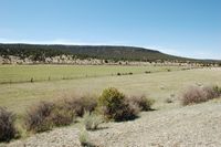
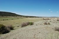
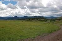
Property Description
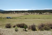
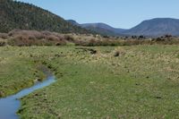
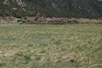
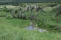
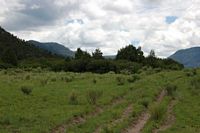
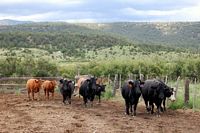
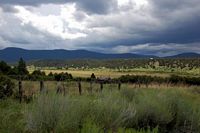
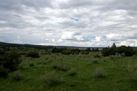
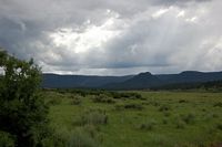
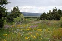
The property is primarily vacant range land overlooking Nutrioso and Colter Creeks with irrigated and sub irrigated meadow adjacent to the stream. There are 33.8 acres of grandfathered water rights from Nutrioso Creek utilized for irrigating native and improved pasture. The property is irrigated via dirt ditches which gravity flow from Nutrioso Creek. The creek typically flows heavily during the spring snow melt and in the later summer during the monsoon season. Perennial flow is typically limited to a small meandering stream. There are some scattered pinion/juniper woodlands on the property surrounded by open grassland covered hills which overlook the creek.
Utilities
Public telephone and electricity is available to the property boundary but is not currently in use or hooked up to the property. Frontier Communications is the telephone provider and Navopache Electric Cooperative is the electric provider.
Flood Zone
Flood Zone C: areas of minimal flood hazard and Flood Zone A: areas of 100-year flood hazard which are located along the creek channel.
Price
Reduced to $1,000,000 from $1,200,000 – Cash
Available as all or part
Printable Brochure
 Please
click here to download (about 3MB) a
printable brochure in Adobe Acrobat format. If you get frustrated
trying to make this work on your computer, don't hesitate to ask us
to mail you a printed and bound brochure instead.
Please
click here to download (about 3MB) a
printable brochure in Adobe Acrobat format. If you get frustrated
trying to make this work on your computer, don't hesitate to ask us
to mail you a printed and bound brochure instead.
Contact
Offered
for sale exclusively by:
Traegen H. Knight
Headquarters West, Ltd.
PO BOX 1980
St. Johns, AZ 85936
Phone: (928) 524-3740, Fax: (928) 563-7004, Cell: (602) 228-3494
Email: info@headquarterswest.com
Web: www.headquarterswest.com/nutrioso
Disclaimer:
This information was obtained from sources deemed to be reliable but
is not guaranteed by the Broker. Prospective buyers should check all
the facts to their satisfaction. The property is subject to prior
sale, price change, or withdrawal.
Keywords
- real estate , land , property , near n s e
w north south east west