***
OFF THE MARKET ***
Escudilla Forest Inholding
Apache County, Arizona
Pictures
Please
click on any of the pictures for a larger view
|
|
|
|
|
[1]
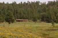
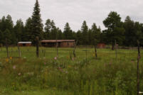
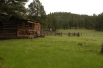
Historic log cabin
|
[2]
|
[3]
|
|
|
|
|
|
[4]
|
[5]
|
[6]
|
|
|
|
|
|
[7]
|
[8]
|
[9]
|
Location & Maps
Please click on any of the maps
for a larger view
|
|
|
|
|
|
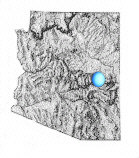
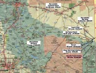
General
location in Arizona
|
Location
map
|
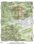
Topographic
Map
|
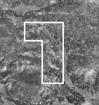
Parcel
Map
|
The
property is located in eastern Arizona near the New Mexico state
line in southern Apache County, approximately 200 miles northeast
of Phoenix, Arizona and 170 miles southwest of Albuquerque, New
Mexico. The property is situated on the eastern slope of Escudilla
Mountain, 1 mile west of the New Mexico state line, 21 miles southeast
of Springerville and 10 miles north of Alpine, Arizona.
Access is provided by 8 miles of US Hwy 180 south from Springerville
to Forest Road #275, then southeast 12 miles to Forest Road #577A,
then 1 mile southeast to the property.
Access from Alpine is provided by 10 miles north on Forest Road
#275, then 1 mile southeast on Forest Road #577A to the property.
Forest Road #275 is a well maintained, graded, gravel road from
US Hwy 180.
Land Tenure
160 deeded acres
Legal Description
Township 6 North Range 31 East
Gila and Salt River Baseline and Meridian
Section 10: Portion thereof
Apache County Assessor parcel numbers: 101-55-002
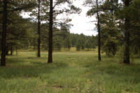
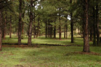
Property Description
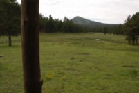
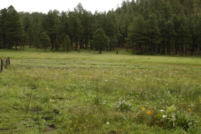
The property is completely surrounded by the National Forest on
all sides and is mostly tree covered with secluded mountain meadow
openings at the lower end. Building improvements are located at
the edge of the meadow overlooking the spring-fed meadows and
stock pond. There is a 3 room rustic log cabin (photos 1,
2, and 3 above)
and a 2-room cowboy house on the property which could be restored
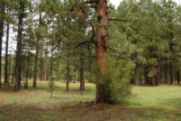
for historic value. There are numerous large Ponderosa
Pines on the property over 30 inches in trunk diameter.
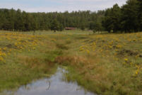
Water
Mountain springs are used for livestock water. One spring has
been developed for domestic water use (photo 3)
and typically runs between 3 and 6 gallons per minute.
Vegetation
Montane Conifer Forest with Ponderosa
Pine, Blue Spruce
and Oak trees. Primary
grasses include Kentucky
bluegrass, pine
drop seed and mountain
muhly.
Climate
Average annual precipitation ranges from 18 to 20 inches with
the majority coming in the late summer months during the monsoon
season and during mid-winter in the form of heavy snow. Winter
access is often restricted by accumulations of snow over a foot
in depth.
|
§
|
Mean
Min
|
Mean
Max
|
| January |
44.6º
|
77.8º
|
| July |
11.6º
|
45.4º
|