|
San
Pedro River Farm
Picture
Location
& Maps
Please
click on any of the maps for a larger view
|
|
|
|
|
|
General
whereabouts in Arizona
|
USGS
satellite image
|
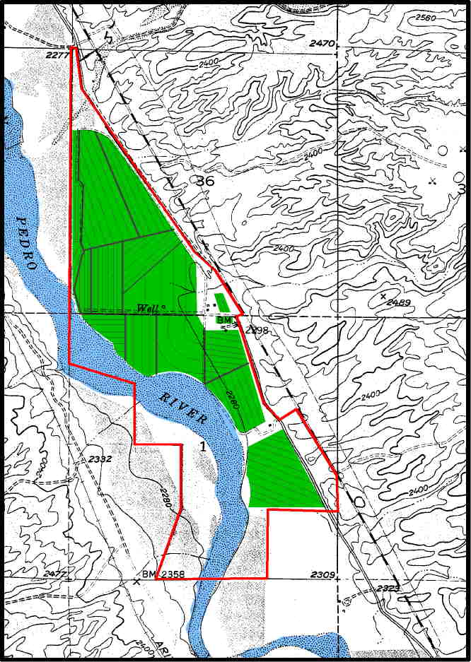
Platt map
|
Topography/road
map
|
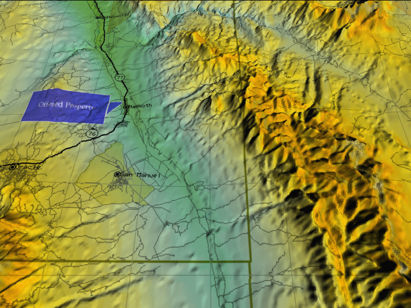
The
San Pedro River Farm is located in eastern Arizona on Highway 77 approximately
forty-eight miles south of Superior and two miles north of Mammoth.
Globe is approximately fifty-three miles to the north. Tucson the closest
major city is fifty-two miles to the south. The farm is accessible directly
off Highway 77.
Land Tenure
528 acres Deeded;
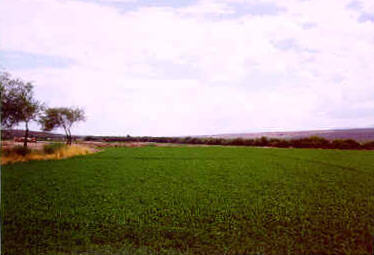
305 acres of irrigated farmland in alfalfa.
Topography
The irrigated portion
of the farm is leveled for flood irrigation with a few terraced fields
the elevation of the farm is 2280 to 2,298 feet above sea level.
Climate
This area has a mild
year around climate. The average temperature high from June to September
is in the low 90s. The average low is in the high 60s. The average
high temperature from October through May is in the low 70s. The average
low is in the low 40s.
Improvements
The improvements
at the Headquarters include the main residence, approximately 1985 square
feet. A 1200 square foot mobile home. Two hay sheds. 2800 sq.ft.. and
2400 sq.ft. and a 1650 square foot work shop/ garage.
Water
There are 4 wells
currently irrigating the farm though a concrete ditch system. The wells
are from 98 to 120 feet deep with the water level less than 50 feet.
Utilities
Electricity and telephone
service are available to the farm.
Price
$790,000
Contact
Offered
for sale exclusively by:
Con Englehorn or Mat Englehorn
Headquarters West, Ltd.
810 North 2nd Street
Phoenix, AZ 85004
Phone (602) 258-1647 Fax (602)340-0927
E-mail info@headquarterswest.com
Disclaimer:
This information was obtained from sources deemed reliable but is
not guaranteed by the broker. Prospective buyers should check all
the facts to their satisfaction. The property is subject to prior
sale, price change or withdrawal.
|