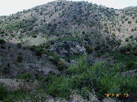
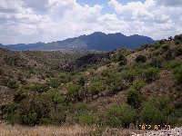
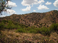
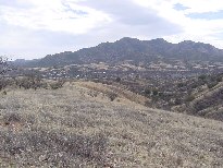
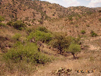
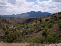
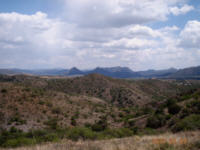
Pictures
Please click on any of the pictures
for a larger view
|
|
|
|
|
[1]
|
[2]
|
[3]
|
|
|
|
|
|
[4]
Patagonia
|
[5]
|
[6]
|
|
|
-
|
-
|
|
[7]
|
-
|
-
|
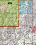
Location
& Maps
Please click on any of the maps
for a larger view
|
|
|
|
|
Location
within Arizona |
Topo
map |
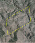
Aerial
map |
Roughly
two miles northwest of Patagonia, Arizona and 66 miles southeast of
Tucson, Arizona. The property is nestled in the beautiful foothills
of the Santa Rita Mountains and is adjacent to the Coronado National
Forest.
Weather
Summers
and winters are comparatively mild, temperatures vary from a daily
maximum mean of approximately 58 degrees during the month of January
to a daily maximum mean of approximately 88 degrees during the month
of July. Annual rainfall averages about 17 inches.
Wildlife
Wildlife include mule deer,
white tail deer, bobcat,
mountain lion, javelina,
coyote, fox,
badger, and squirrels.
Quail and a wide variety of
birds and other small game reside here.
Comments
If you are looking for seclusion, this is the
place for you with 120 acres with views in all directions. The small
picturesque town of Patagonia (please
see photo [4] above) is
located just south of the ranch offers public schools with education
from kindergarten through high school. Nogales International Airport
is about fifteen miles from the ranch, and Tucson International Airport
is just a little over an hour's drive.
Price
$120,000
Printable
Brochure
 Please click here to download (about 600kb)
a printable brochure in Adobe Acrobat format. If you get frustrated
trying to make this work on your computer, don't hesitate to ask us
to mail you a printed and bound brochure instead.
Please click here to download (about 600kb)
a printable brochure in Adobe Acrobat format. If you get frustrated
trying to make this work on your computer, don't hesitate to ask us
to mail you a printed and bound brochure instead.
Disclaimer: This information was obtained
from sources deemed to be reliable but is not guaranteed by the Broker.
Prospective buyers should check all the facts to their satisfaction.
The property is subject to prior sale, price change, or withdrawal.