
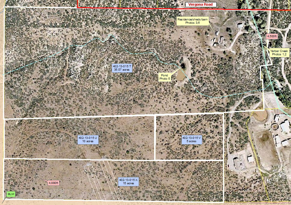
Aerial
Map
Please click here or press the "Back" button
on your browser to return to the brochure.
|
Sources: |
Yavapai County USGS Humboldt Quad FEMA Arizona State Land Department Arizona State Land Department |
|
|
|
Disclaimer: This information was obtained from sources deemed to be reliable but is not guaranteed by the Broker. Prospective buyers should check all the facts to their satisfaction. The property is subject to prior sale, price change, or withdrawal. |
|||