***
SOLD ***
Hunt Property
Apache County, Arizona
Pictures
|
|
|
|
|
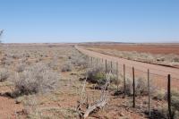
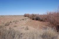
[1]
County Road, Eastern Boundary
|
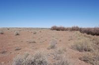
[2]
Field
|
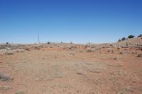
[3]
Field
|
|
|
|
|
|
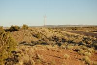
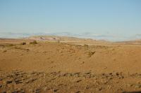
[4]
Highway Frontage
|
[5]
Little Colorado River
|
[6]
Northern Bounday
|
|
|
|
|
|
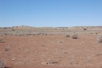
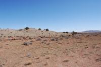
[7]
Rolling Hills
|
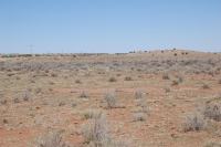
[8]
Rolling hills
|
[9]
Rolling hills
|
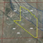
Maps
|
|
|
|
|
|
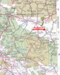
Area
map
|
Topo
map
|
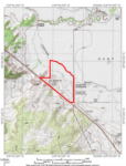
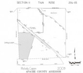
Plat
map
|
Aerial
|
Location
& Access
The property is located at the intersection of US Highway 180 and
180A in the Hunt Valley along the Little Colorado River in Apache
County approximately 18 miles northwest of St. Johns and 10 miles
north of Concho, Arizona. Access is provided by paved US Highway 180
with nearly one mile of frontage. County Road #5392 provides access
along the eastern boundary of the property.
Land
Tenure
189.2 deeded acres
Legal
Description
Township 14 North Range 25 East
Gila and Salt River Baseline and Meridian
Portion of Section 11: lying north of US 180 and south of the Little
Colorado River.
Apache
County Assessor parcel number:204-05-003A (portion thereof, to be
a parcel split)
Property
Description
The property consists of vacant land with rolling hills and nearly
level meadowland adjacent to the Little Colorado River (photo [5]).
There is a small area which has been used in the past for a gravel
pit and there are is a small amount of gravel resources remaining
on the property. The boundary includes nearly one mile of highway
frontage (photo [4]) and over a half
mile of the river. County Road #5392 is the eastern boundary (photo
[1]) of the property while US Highway
180 makes the southern boundary and the Little Colorado River is the
northern boundary of the property.
Vegetation
Vegetation includes plains and desert grassland with scattered juniper
trees on the rolling hill portion. The low land near the river is
nearly level open grassland with chamisa and sage. The low land was
cleared for farming many years ago, but has mostly been grown in with
native vegetation. The property has not been farmed in over forty
years, but could possibly be put back into production if a irrigation
type well were drilled.
Water
There is no developed water on the property but wells in the area
are less than 100 feet deep. The Little Colorado River has a seasonal
flow and typically only runs during the summer monsoon months.
Utilities
Public telephone and electricity is available to the property boundary
but is not currently in use or hooked up to the property. Frontier
Communications is the telephone provider and Navopache Electric Cooperative
is the electric provider.
Flood
Zone
Flood Zone C: areas of minimal flood hazard and Flood Zone A: areas
of 100-year flood hazard. Please see flood map.
Price
$208,000 - Cash
Contact
Offered
for sale exclusively by:
Traegen H. Knight
Headquarters West, Ltd.
PO BOX 1980
St. Johns, AZ 85936
Phone: (928) 524-3740, Fax: (928) 563-7004, Cell: (602) 228-3494
Email: info@headquarterswest.com
Web: www.headquarterswest.com/hunt
Disclaimer: This information was
obtained from sources deemed to be reliable but is not guaranteed
by the Broker. Prospective buyers should check all the facts to their
satisfaction. The property is subject to prior sale, price change,
or withdrawal.