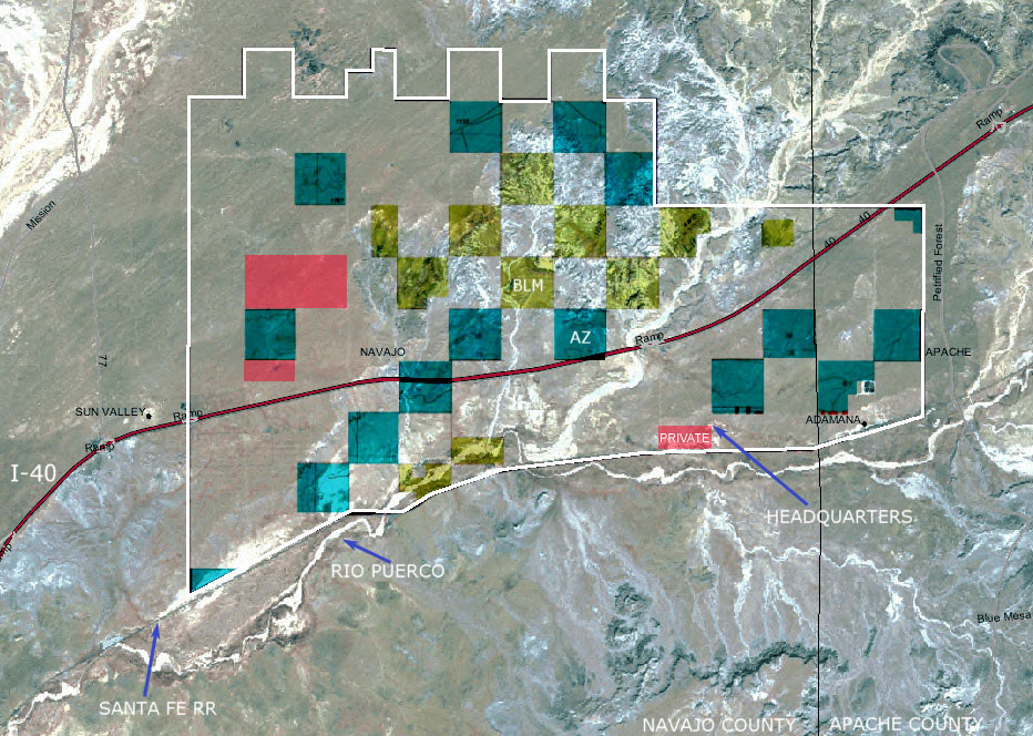
Satellite
Image
Source: Landsat Enhanced Thematic Mapper Plus, false color composite - 1999.
The ranch boundaries are approximate in this map.
The largest red
portion (2 sections) contains numerous scattered parcels of deeded land included
in the sale -
the parcels are chopped up and difficult to map - please contact the broker
for details.
Please click
here or press the "Back" button on your
browser to return to the brochure.