|
§ Return
to all of our listings
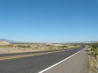
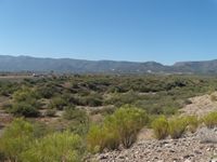
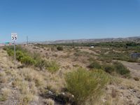
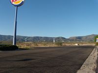
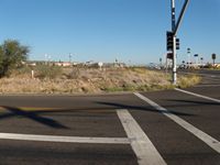
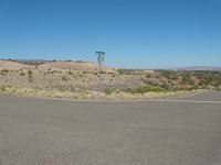
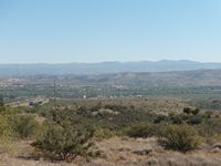
*** OFF THE MARKET *** Camp Verde I-17 & SR 260 Property Pictures Please click on any of the pictures for a larger view
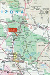
Location and Maps
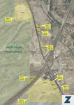
Location Description Tract #2: Located ½ of a mile north and west of the intersection of I-17 & SR 260 on the east side of SR 260. Tract 2 has about 475’ frontage on SR 260, tract 2 also has frontage and access from Dreamcatcher Drive on the east side. Tract 2 is zoned by the Town of Camp Verde C3, a commercial and minor industrial district in the Town of Camp Verde. The dimensions of tract 2 are fairly triangular measuring about 475’ north to south by 130’ at the south end east to west. According to FEMA FIRM Map #04025C Panel #2185F with an effective date of 6/6/01, tract 2 does not have any flood hazards. Tract 2 borders SR 260 to the west, Dreamcatcher Drive to the east and other vacant land to the south. Tract 2 consists of Assessor Parcel Number 403-21-015H. Tract #3: Located ½ of a mile north and west of the intersection of I-17 & SR 260 on the east side of SR 260. Tract 3 has about 250’ frontage on SR 260, tract 2 also has frontage and access from Dreamcatcher Drive on the east side. Tract 2 is zoned by the Town of Camp Verde C3, a commercial and minor industrial district in the Town of Camp Verde. The dimensions of tract 3 are fairly rectangular measuring about 250’ north to south by 70’ at the north end east to west. According to FEMA FIRM Map #04025C Panel #2185F with an effective date of 6/6/01, tract 3 does not have any flood hazards. Tract 3 borders SR 260 to the west, Dreamcatcher Drive to the east, Wilshire Blvd to the south, and other vacant land to the north. Tract 3 consists of Assessor Parcel Number 403-21-015J. Tract #4: Located at the hard corner of the southbound I-17 off ramp and SR 260, tract 4 has 750’ frontage on SR 260 and 875’ frontage on Dreamcatcher Dr. Tract 4 is zoned by the Town of Camp Verde C3, a commercial and minor industrial district in the Town of Camp Verde. The dimensions of tract 4 are fairly rectangular measuring about 750’ north to south by 125’-150’ east to west. According to FEMA FIRM Map #04025C Panel #2185F with an effective date of 6/6/01, tract 4 does not have any flood hazards. Tract 4 borders SR 260 to the west, Dreamcatcher Drive to the east and ADOT right of way land to the north and south. Tract 4 consists of Assessor Parcel Number 403-22-019B. Tract #5: Located ¼ mile south of I-17 & SR 260 intersection on the southbound I-17 lane, tract 5 has 750’ frontage on Interstate 17. Tract 5 is zoned by the Town of Camp Verde R1L-70, a residential single family limited district in the Town of Camp Verde. The dimensions of tract 5 are fairly triangular measuring about 560’ north to south by 500’ east to west on the north end. According to FEMA FIRM Map #04025C Panel #2185F with an effective date of 6/6/01, tract 5 does not have any flood hazards, however there is a smaller wash on the tract which will run water during times of heavy rainfall. Tract 5 lacks physical access currently and the condition of legal access is unknown, Tract 5 borders Prescott National Forest to the west, other vacant land to the north, and Interstate 17 to the east and south. Tract 5 consists of Assessor Parcel Number 403-22-035E. Tract #6: Located at the around the hard corner of the northbound I-17 off ramp and SR 260, tract 6 has ¼ mile frontage on Interstate 17, 775’ frontage on SR 260, 975’ on George Rothrock Lane and 330’ on Homestead Parkway. Homestead Parkway is a lighted intersection on SR 260. Tract 6 is zoned by the Town of Camp Verde C2, a general sales and services commercial on about 9 acres with the remaining acreage being zoned by the Town of Camp Verde R1L-70, a residential single family limited district. The dimensions of tract 6 are fairly rectangular measuring about 880’ to 1,900’ north to south by ½ mile east to west at the south end. According to FEMA FIRM Map #04025C Panel #2185F with an effective date of 6/6/01, tract 6 does not have any flood hazards, however there is a wash that will run with heavy rainfall. Tract 6 borders State Trust land to the south, Prescott National Forest to the west, multiple fast food, retail and hotels along with Interstate 17 on the north, and SR 260 to the east. Tract 6 also has a right of way from the southern end across State Trust land that connects to the lighted intersection of SR 260 and Finnie Flat Road. Tract 6 consists of Assessor Parcel Numbers 403-22-035A and 403-22-035H. Acreage
Utilities 2013 Taxes & Assessments
The estimated population of the Verde Valley in 2010 is 77,000, of which a large percentage of the population is in unincorporated areas of Yavapai County. Comments Price Printable Brochure Contact Disclaimer:
This information was obtained from sources deemed to be reliable
but is not guaranteed by the Broker. Prospective buyers should check
all the facts to their satisfaction. The property is subject to
prior sale, price change, or withdrawal. |